GNSS Orbits and Clock Products
Research question: How can we incorporate signals from all available GNSS constellations in order to get a more accurate position?
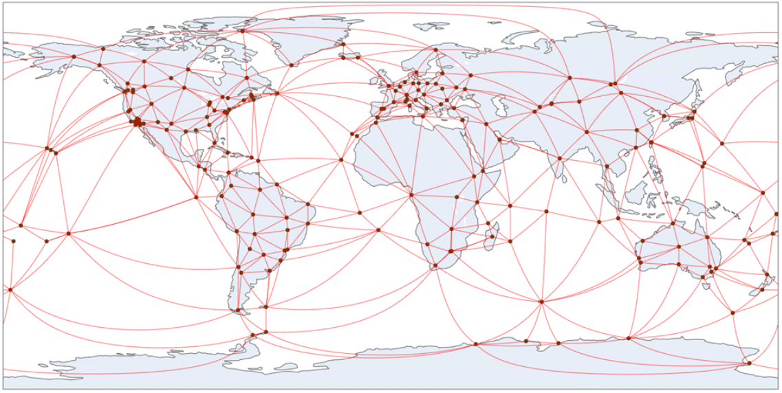
Navigation satellites, also known as Global Navigation Satellite Systems (GNSS) provide the fundamental reference data from which all modern terrestrial reference frames, including the United States National Spatial Reference System (NSRS), are defined. Satellite ephemerides—that is, precise data on where these satellites are at any moment—serve as beacons in space that we can always see and from which we may compute ranges using Continuously Operating Reference Stations (CORS) to figure out exactly how Earth is oriented in space, and where things are located on Earth’s surface. Without access to precise, timely orbital data products, the National Geodetic Survey (NGS) would be unable to fulfill its core mission: “To define, maintain, and provide access to the NSRS to meet our nation’s economic, social, and environmental needs.”
Stakeholders of the NSRS are increasingly reliant on applications requiring multi-GNSS data, with multiple cost- and time-saving benefits, such as decreasing the data-collection times required to achieve a given precision, and ensuring higher precision in ports, cities, canyons, forests, or other environments with obstructed sky visibility. There is a clear economic benefit associated with having a multi-GNSS capable NSRS. As such, NOAA is now investigating multiple GNSSs, not only the US-operated Global Positioning System (GPS). Following the rapid advancements in geospatial technologies in nearly all sectors–commercial, academic, federal, and state, NOAA’s GNSS research efforts now include research and development of precise orbital products for multiple satellite constellations, including GALILEO (European), GLONASS (Russian), and BeiDou (Chinese).
With the advent of GPS in the early 1980s, United States federal, commercial, and academic institutions led the world in the development of the modern satellite geodetic theory, instruments, and applications that we now take for granted. NGS, in particular, took a leading role in the conception, deployment, and proof of concept of global geodetic networks (cf. CIGNET) specifically for precise orbit determination in support of the United States’ ever more demanding Positioning, Navigation, and Timing requirements. In the process, the US satellite geodesy community enabled navigation, ranging, and timing capabilities that fueled the United States’ now trillion dollar geospatial economy, indispensable national and international infrastructure (e.g., the NOAA CORS Network, the International GNSS Service network), as well as transformative scientific programs (e.g., NSF’s EarthScope Program, and many others).
NGS is one of a dozen GNSS Analysis Centers from around the world that operationally produces world class orbital ephemerides for GPS satellites as demonstrated through our orbital product contributions to the International GNSS Service (IGS) that provides a combined solution to determine satellite orbits, station positions, and Earth rotation parameters. NGS generates two orbit products: rapid and final. The rapid orbits are available daily within 17 hours after Universal Coordinated Time (UTC) midnight and are aligned to the IGS Reference Frame. The final orbit products are available within 12 days and are also aligned to the IGS Reference Frame, but in a way that accounts for transient motions of the Earth’s center of mass. NGS provides station positions only for the final orbit products.

NGS contributes GPS orbits and Earth Rotation Parameters to the IGS data holdings. With the new M-PAGES software currently under development, NGS is working towards multi-GNSS orbits and clock products. There is a clear economic benefit associated with a multi-GNSS capable NSRS. As a results, US-based stakeholders that are increasingly reliant on applications requiring multi-GNSS data will benefit from multiple cost- and time-saving benefits, such as decreasing the data-collection times required to achieve a given precision, and ensuring higher precision in ports, cities, canyons, forests, or other environments with obstructed sky visibility.
Resources and References
Federal Geographic Data Committee (2018). The Geospatial Data Act of 2018 (GDA), October 5, 2018 (H.R. 302, P.L. 115-254). https://www.fgdc.gov/gda
Griffiths, J and J. Ray. 2009. “On the precision and accuracy of IGS orbits,” J Geodesy 83:277–287
Jones, J. 2022. “GNSS Orbit Determination,” NGS Webinar Series, September 8, 2022. https://geodesy.noaa.gov/web/science_edu/webinar_series/gnss-orbit-determination.shtml
Mader, G.L. 1993. “CIGNET and NGS Orbit Production Experiences Related to the IGS,” In: Mader, G.L. ed. Permanent Satellite Tracking Networks for Geodesy and Geodynamics. International Association of Geodesy Symposia, vol 109. Springer, Berlin, Heidelberg. https://doi.org/10.1007/978-3-642-77726-4_5
National Geodetic Survey 2019. The NGS Strategic Plan, 2019-2023, NGS document, 60 pp., Silver Spring, MD, USA. https://geodesy.noaa.gov/web/about_ngs/info/documents/ngs-strategic-plan-2019-2023.pdf
NGS GPS Orbit Determination. https://geodesy.noaa.gov/library/pdfs/GPS_Orbit_Determination.pdf.
NOAA National Geodetic Survey. Computing GPS Orbits. https://beta.ngs.noaa.gov/orbits/.
NOAA National Geodetic Survey. Products and Services of the IGS Analysis Center at NGS. https://geodesy.noaa.gov/INFO/OnePagers/Orbit_Data.pdf.
Nykiel, G., J.A. Cahuasquí, M.M. Hoque, N. Jakowski. 2024. “Relationship between GIX, SIDX, and ROTI ionospheric indices and GNSS precise positioning results under geomagnetic storms,” GPS Solut 28, 69 . https://doi.org/10.1007/s10291-023-01611-5.
Schenewerk, M. S. 1991. “GPS orbit determination at the National Geodetic Survey.” Presentation at 23rd Annual Precise Time and Time Interval (PTTI) Applications and Planning Meeting, Pasadena, CA. https://ntrs.nasa.gov/api/citations/19920024110/downloads/19920024110.pdf
Snay, R. A. and T. Soler. 2008. “Continuously operating reference station (CORS): history, applications, and future enhancements,” Journal of Surveying Engineering, 134(4), 95-104. https://doi.org/10.1061/9780784411643.ch01
White House 2022. Office of Management and Budget’s (OMB) Circular No. A-16 Revised, White House, August 19, 2022. https://www.whitehouse.gov/wp-content/uploads/2017/11/Circular-016.pdf
Yao, J., S. Yoon, B. Stressler, S. Hilla, and M. Schenewerk. “GPS satellite clock estimation using global atomic clock network” GPS Solut 25, 106 (2021). https://doi.org/10.1007/s10291-021-01145-8.
Yoon, S., J. Saleh, J. Heck, K. Choi, S. Hilla , M. Schenewerk.2017. NGS analysis center technical report 2017 (Eds. A. Villiger, and R. Dack). IGS Technical Report 2017, 90-92. https://files.igs.org/pub/resource/pubs/2017_techreport.pdf
