What is GRAV-D?
GRAV-D stands for Gravity for the Redefinition of the American Vertical Datum
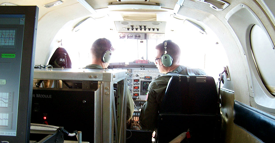
The pilot and co-pilot of a Navy-owned King Air aircraft prepare for takeoff on a data collection flight with GRAV-D instruments (fore and mid-ground) and a GRAV-D operator as their payload.
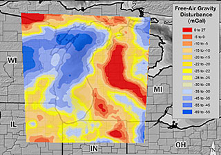
Map of variations in Earth's gravity as measured by the GRAV-D airborne instruments over Lake Michigan and surrounding states.
So, what does that mean? First, to define a couple of terms: Gravity is the force that causes objects to fall to, and stay on, the ground. Datums are the basis for all geodetic survey work, and vertical datums are used to measure land elevations and water depths.
The vertical datum is determined, or "realized," through a collection of specific points on the Earth with known heights. In 2007, NOAA’s National Geodetic Survey began a 15-year project to redefine the datum based on gravity measurements.
GRAV-D measures and monitors Earth’s gravity field to support the geoid—a model of roughly global mean sea level used to measure precise surface elevations—so that it may serve as the “zero reference surface” for all heights in the nation. Accurate heights are critical to many scientific endeavors, but are particularly important for protecting low-lying coastal ecosystems.
Variations in the size, shape, and mass distribution of the Earth cause slight variations in the “strength” of gravity’s pull. GRAV-D measures gravity from an aircraft and those data are combined with satellite and surface gravity measurements to create the geoid. When the project is completed in 2022, the geoid will be applied to satellite position measurements like GPS to obtain extremely accurate heights (to within 2 cm where possible).
It is estimated that GRAV-D will provide $4.8 billion in socioeconomic benefits to the United States through improved floodplain mapping, coastal resource management, construction, agriculture, and emergency evacuation planning.

