Gravity for Geodesy II: Applications
Skill Level: 2
Completion Time: .75 - 1.00 h
This lesson is temporarily unavailable
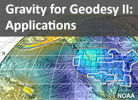
Description: Gravity is an important part of geodesy, with implications for height measurements and many other applications. In this module, we explore the concept of equipotential surfaces and relate them to gravity. Then we discuss geodetic applications that rely on accurate gravity measurements, including leveling surveys and floodplain mapping. We introduce a special surface based on gravity, called the gravimetric geoid, and explain why we want to use it as a reference datum. We discuss how to measure Earth’s gravity and introduce you to the National Geodetic Survey’s GRAV-D project, including how and why the U.S. and a number of other countries plan to use a gravity-based vertical datum.

